


The first question I was asked was: why visit Thailand in a camper?
There are many reasons:
- You can sleep in the heart of the most inaccessible natural parks, staying past closing time when the day tourists return at guesthouse where they stay.
- You can reach places outside of mass tourism, discovering hidden waterfalls and isolated roads that are used by elephants.
- You can wander among the ruins of the most distant and fascinating temples, sleep just behind a large what and enjoy it at dawn, when no one has yet arrived, choosing where to stop based on the emotion of the moment and without worrying about the cleanliness of the bathrooms or the company of insects in the bed.

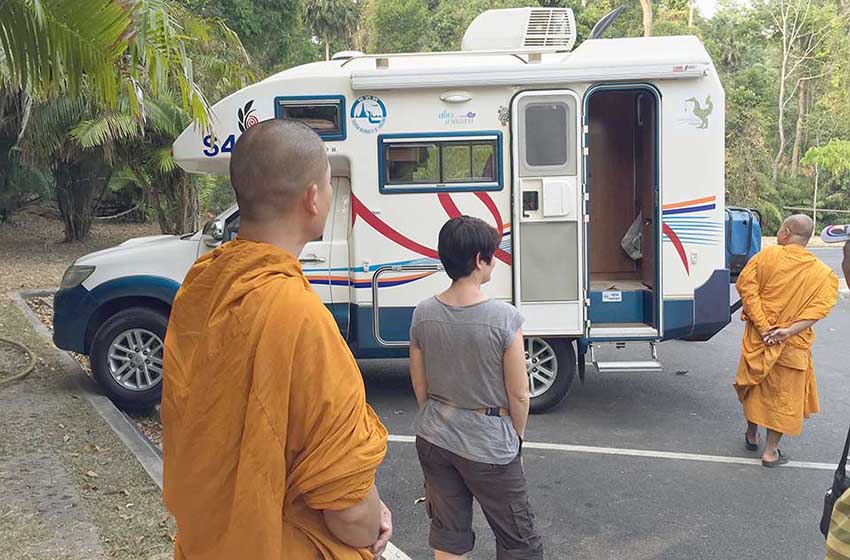
Such a cheap country to sleep and eat, so well organized for backpacker, may seem like an inadequate destination for camper tourism but the Thailand, on the other hand, is ideal for pleinair. We reached remote locations not served by tourist buses and wild protected areas where no one speaks English and the inhabitants - everyone, even the monks of the temples - stopped us, amazed and enthusiastic, asking us to visit our strange vehicle.
FIRST STEP
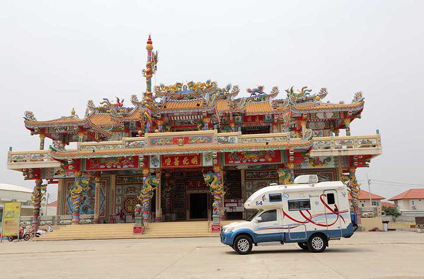
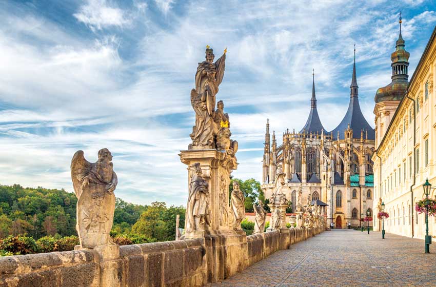
The temple of Wat Sothon Wararam
The route we present starts from the Total Travel camper rental, on the eastern outskirts of Bangkok, near the airport, avoiding entering the crowded metropolis of seven million inhabitants. We head towards Chachoengsao – about 35 kilometers – leaving out countless tourist indications; near the town there are the first signs for Wat Sothon Wararam, one of the most popular temples in the region, linked to the legend of the Buddha statue that reemerged clean and shining from the mud of the river.

The large monastic complex is clearly visible and has a large rear car park near the wing still under construction (N 13.67222°, E 101.06540°). Not far away is also the small floating market of Ban Mai, with some traditional stilt houses on the canals and some sellers in rowing boats (only in the morning).
Il Khao Yai national park
To continue the journey towards the Khao Yai national park you have to cross the city towards Phanom Sarakham and Kabin Buri on road 304, then turning onto the well-signposted 319 for Prachin Buri. The agricultural and industrial area is not the most scenic, but once you pass the last town the atmosphere begins to become more exotic and you arrive at the southern entrance to the protected area, the smallest and most pleasant (warning: many satellite navigators do not have of the park's internal road and indicate only the northern entrance).
Going up towards the cool plateau in the late afternoon is an excellent opportunity to spot the elephants which at sunset, when the visitors leave, move onto the road to go and drink. After a couple of kilometers of curves you come across the sign for the Narok Haew waterfall path, one of the highest and most isolated in the protected area. Continuing further you reach the training center of rangers and campsites: the Lam Ta Khong (N 14.43141°, E 101.39690°) is the largest and best organised, a large grassy space overlooking a stream and a corner of forest where it is easy to spot large toucans.

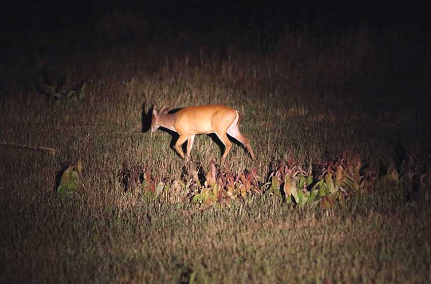
In the evening it is frequented by Asian hedgehog and by the curious civets (mustelids similar to large striped martens), while Asian deer (the small montjaks and the large sambars), monkeys and squirrels run freely among the tents. The walls of the structures are a sure spot to spot giant geckos, whose song will keep you company for the night.
The campsite does not have a market - the small shop and the restaurant close at 17pm - which is instead present at Pha Kluai Mai, a smaller structure with more basic bathrooms located at the start of the path to the Haew Suwat waterfall, the one where dive Leonardo DiCaprio in The Beach. You have to allow at least two hours of walking to reach it, while thousands of butterflies flutter around and you have a good chance of spotting the otters and the crocodile that lives in the pool - bathing is prohibited! – located about an hour from departure.

Excursions and guided tours
Once again on the main road, in a few kilometers you reach the lively visitor center with restaurants, cafes and bungalows where you can book guided tours and night excursions in pick-ups, but unfortunately the guides do not speak English. Don't miss, however, the trek that starts at Km 33 (well signposted, but only a small car park along the road): a three-hour hike through forests of giant ficus and cinnamon trees to reach the elephant watchtower Nong Phak Chi.

Continuing north instead you arrive at a panoramic point very frequented by macaques (be careful of food thefts), then you exit through the main entrance, crowded with stalls, with a nice temple dedicated to the spirits of the forest.
SECOND STAGE
The city of Lopburi
Highway 2 crosses a plain that is uninspiring with its views but full of genuine Thai life (restaurants, stalls, street food, spirit houses and flashy new temples) until it reaches Highway 1 and the well-marked town of Lopburi, one of the most flourishing in the Dvaravati period (6th-13th century), where monkeys flocked the Khmer temple of Prang Sam Yot. The main archaeological attractions, all well signposted, are concentrated near the Wat Phra Sri Ratana Mahathat temple, where the car park (N 14.79867°, E 100.61031°), the station and the Royal Palace Museum are also located. The city can be easily visited on foot, but it can be very dirty and dusty in the dry season.

lI Thung Salaeng Luang National Park
Backtracking a little, Highway 21 heads north towards Phetchabun, giving a few glimpses imposing Buddhas newly built on the hillside. At Lom Sak we turn onto national road 12, lined with farms and stalls selling strawberries and tamarind fruits grown in the surrounding woods, in an area of high, steep hills known as the Via Verde and covered in Dry Evergreen Forest, the deciduous monsoon forest, which turns yellow and loses its leaves in the dry season.
At kilometer 80 there is the entrance to the camping area Thung Salaeng Luang National Park (N 16.84292°, E 100.88006°), an enchanting space with bungalows and parking on the Khek River, ideal for spending the night and discovering the paths to the caves in the cool of the morning.

THIRD STAGE
Sukhothai Archaeological Park
Continuing further along the main road you come across the accesses to the Kaeng Sopha waterfall, the largest in the park (Km 71-72, entrance fee), and two waterfalls much used by the local population (Km 59 and Km 33, free), which may have little water in the dry season.
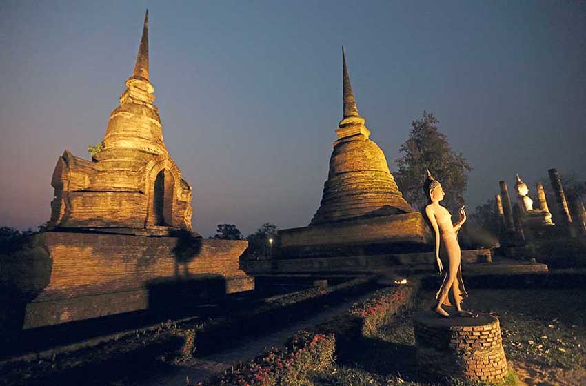
Leaving the hills, with the expressway 12 you can easily reach thearchaeological area of Sukhothai, capital of the ancient kingdom that bore his name; from here in the 13th century the first writing began to spread thai. Inserted by UNESCO in the list of world heritage sites, the site is so large - twenty-one monuments and four sacred ponds - that it is divided into three paid sectors.

It is located thirteen kilometers from the new city, so it is best to ignore the first green signs and continue on the 125 ring road for almost twenty kilometers thus arriving at the main entrance to the central area, which is open free of charge from 18pm: just in time for the sunset on the great Wat Mahathat or Wat Sa Si.

For the night, the large grass car parks immediately outside the archaeological area are excellent and rather quiet. For the magnificent panorama we recommend the Wat Si Chum, the great Buddha (N 17.02703°, E 99.69477°) behind Wat Phra Phai Luang or Wat of the Elephants, near the entrance on the northern side; there is a combined ticket for all attractions, including the museum which houses numerous Buddha statues. Both the western and southern areas, too distant to reach on foot, can be visited for free with VR, driving through the jungle among the ruins of abandoned temples.

In case the heat is too oppressive to sleep in the city, we suggest staying overnight at Si Satchanalai National Park, at Km 21 of road 101 towards Kamphang Phet, where a cool hill (closing at 17.30 pm) offers the possibility of choosing a path and making pleasant excursions.
FOURTH STAGE
The three parks of Khlong Wang Chao, Khlong lan and Mae Wong
About fifty kilometers further south-west is theKamphaeng Phet archaeological area. A first entrance about two kilometers from the city allows you to take a nice camper tour immersed in the forest while in the centre, with some parking difficulties along the road, you can admire the famous Reclining Buddhas.
Then take state road 1 in a southerly direction until the junction for road 1117, very well signposted, for the parks of Khlong Wang Chao, Khlong Lan e Mae Wong. The three neighboring protected areas, with an almost uninhabited area of 18.000 hectares covered by the Western Forest Complex (mixed deciduous dipterocarp forest), constitute the most important Thai area for the conservation of the Asian tiger: twenty-seven dens and more than one hundred have been registered. specimens of the feline, at risk of extinction.

The first stop is the Klong Nam Lai waterfall, indicated before the entrance to the park in the village of Khlong Lan Pattaya (free parking and the possibility of swimming along the small educational trail). Continuing south you will find the entrance to the Mae Wong, the most beautiful and organized of the three parks, with a long and panoramic road that reaches the highest point. There are three possibilities for overnight stay: immediately beyond the entrance (at the visitor centre, where registration takes place), at Km 18 (after the barrier at the first panoramic point beyond the hairpin bends) or at the end of the road, at the highest and coolest point (Km 28; N 16.09962°, E 99.10778°). Behind the park rangers' lodge there is a steep path with steps leading up to the summit (300 meter difference in altitude): it is the ideal site for observing the red-throated toucan, which lives only in this park.

FIFTH STAGE
The city of Ayutthaya
Even further south you come across the main road Ayutthaya, another historic city protected by UNESCO and considered one of the best preserved archaeological areas in Thailand. Most of the ruins, temples and museums are located on the central island created by the waterways: it can be reached by vr and you can also stay overnight, in a small car park among the flowerbeds right in front of Wat Phra Si Sanphet (N 14.35585°, E 100.56162°).

There are also parking options outside the island, in a quiet position in the Wat Chaiwatthanaram car park (N 14.34384° E 100.54102°) or near Wat Thammikarat, the temple of the roosters, which is still very popular. To visit the sites, given the distances, all the guides recommend cycling; but the tour can also be done in a camper, because each monument has parking.
SIXTH STAGE
Erawan National Park
We continue to Suphanburi, U Thong and Phanom Thuan, up to Kanchanaburi. You will then find signs for the waterfalls Erawan National Park, the most famous in the country. Not the best place to sleep; the campsite is hot and noisy, but very convenient for accessing the magnificent seven waterfalls early in the morning, when the droves of day tourists from Kanchanaburi have not yet arrived. The steep Nature Trail starts immediately to the left of the small bridge with ford or 500 meters after the car park.

All the natural pools are suitable for swimming, although you have to get used to the little fish nibbling at your feet. A valid alternative solution for overnight stays is at the Phra That cave, a dozen kilometers away and with a short marked dirt road: you can access it with the same entrance ticket (500 meter uphill path, guides who unfortunately do not speak English).
SEVENTH STAGE
PSri Nakharin national arch
Returning to the main road, approximately 35 kilometers separate from Sri Nakharin National Park and from the path to the Huai Mae Khamin waterfalls: two and a half really intriguing kilometers up to the fourth drop, generally deserted. You can park for the night in front of the visitor center, at the beginning of the walkway (N 14.63720°, E 98.99578°), or near the restaurant (straight to the barrier).

Following the road that becomes a dirt road you can choose a small adventure: a not too bumpy track of about 70 kilometers in the bamboo jungle, with some remote villages of stilt houses, fields of cassava, rubber and coffee, following the signs for the Thong Pha Phum. Always turning left at the main crossroads and abandoning the signs for the northern parks you arrive at the exit checkpoint, a panoramic site overlooking the rainforest, extremely cool, where we recommend staying overnight (N 14.74041°, E 98.81719°).
Read also: “Mauritania by camper: 24-day trip to the land of nomads”
EIGHTH STAGE
PThong Pha Phum National Arch
Going down on the still dirt and then cemented track you arrive on the road to the Pha Tad waterfall, a few kilometers before the village that gives its name to the Thong Pha Phum National Park, beyond a large lake. You then begin to return towards the south meeting the signs for the Dao Dueng cave (parking in front of the first checkpoint, then 500 meters of road and steep uphill path)
PSai Yok national arch
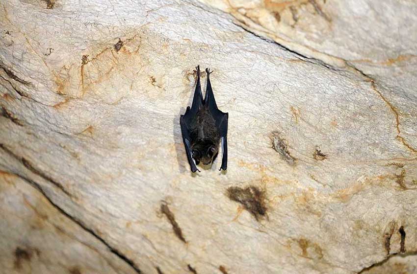
Last stop is the Sai Yok National Park, famous above all for the tiny bumblebee bats with which you can have close encounters in the Kwae cave (300 meters from the parking and camping area, with very narrow access) and the giant bats of Bat Cave, a large cavity 1.500 meters from the entrance, on a path that also crosses the old railway from the Second World War. There Sai Yok waterfall (about 300 meters from the visitor center) flows into the River Kwai: the spectacle is guaranteed with boat excursions, but it is not the best in the dry season. Even in this case the overnight stay in the camping car park is rather noisy and hot.
The village of Kanchanaburi, with the famous bridge over the River Kwai, is the last stop on our trip to Thailand: the main attractions are the War Museum and the cemetery where thousands of allied soldiers are buried.
FORESTS AND NATURAL PARKS
Thailand has one hundred and twelve natural parks: a protection network of rainforests which, thanks to the variety of latitude and altitude, collect the 10% of the biodiversity of all tropical areas. Unfortunately, the jungle is strongly threatened by deforestation: industrial plantations of oil palm, rubber, soya and sugar cane have reduced the wooded area from 70% in the 14s to XNUMX% today. But some of the rarest animals on the planet, from the Asian tiger to the mysterious loris, up to the Indian rhinoceros, are still present on the western side, on the border with Burma.

Uncontrolled deforestation has exacerbated the effects of the prolonged drought of the last five years, causing excessive evaporation and soil erosion, as well as encouraging a series of arson fires set to obtain new arable land. Visiting national parks, paying for entry and overnight stay in campsites, helps to increase resources for the work of park rangers and strengthens the protection of the natural environment. And if you want to contribute once you return home from Thailand, you can limit your consumption of products made with palm oil and the purchase of tropical wood.
RENT THE CAMPER
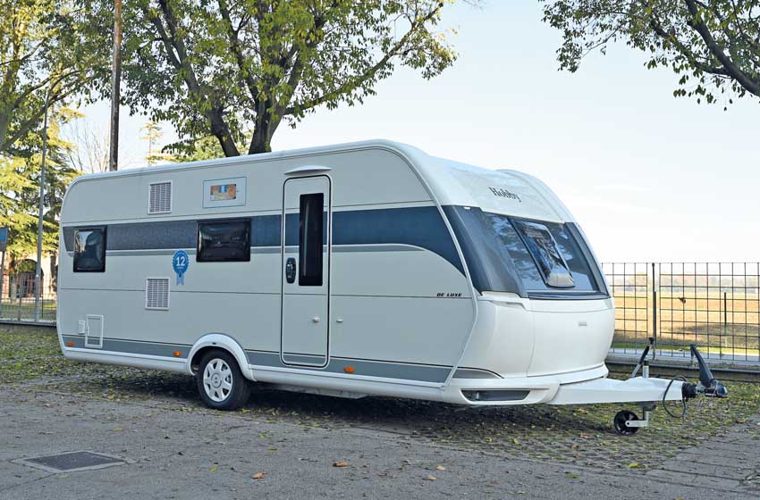
The vehicle we used is a cell on Toyota Vigo pick-up with automatic transmission and the steering wheel in the reversed position, which helps when driving on the left. Comfortable for three or four people (two double beds), it is equipped with a bathroom with shower, two separate tanks for 80 liters of water, electric fridge, air conditioning, petrol generator.
THEinternal setup is in line with the demands of the Asian market, sometimes bizarre for European needs: a lot of space and a large part of the electrical system are used to power a karaoke system with large acoustic speakers, the kitchen is an outdoor stove (given the temperatures it is advisable to cook outdoors) and the microwave oven, like air conditioning, only works if connected to the electricity line or generator).
Il bathroom it has a ceramic toilet and a tank of only five litres: given the lack of camper service, the rental company suggests unloading in plastic bags to then throw in rubbish bins. We recommend checking the condition of the tyres, the spare tire removal system and the condition of the second battery before setting off.
Prices start at 6.000 baht per day, with discounts for stays longer than two weeks (www.cam pervan-thailand.com). A shuttle service ensures the connection between the rental and Bangkok airport.
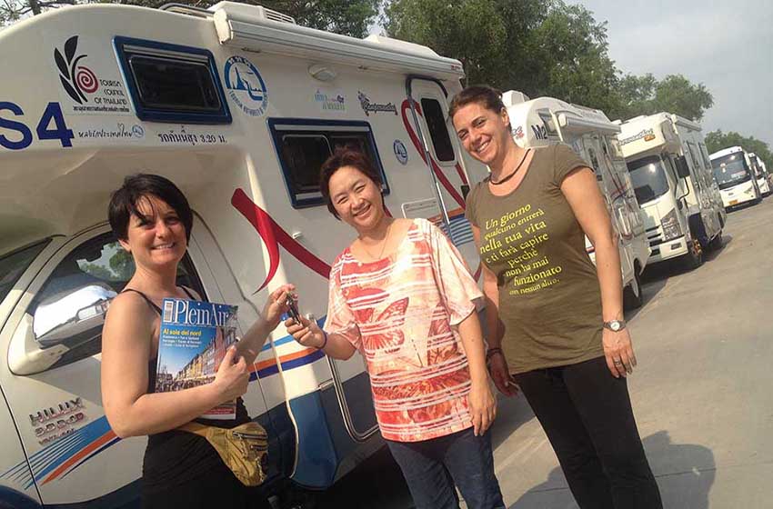
Text by Federica Botta, photos by Alessandro De Rossi
-------------------------
You can read all PleinAir itineraries on Thailand and the rest of the world in the digital magazine on your PC, tablet or smartphone. With a year of subscription to PLEINAIR (11 paper issues) you have the available special inserts, the digital magazine e the digital archive since 2015 (with attachments).
With your PleinAir subscription you receive the next issues comfortably at home and savings!